IIT Guwahati researchers use seismic waves to map the ground under Bihar
In a significant advancement for earthquake preparedness, researchers from the Indian Institute of Technology (IIT) Guwahati have successfully mapped the underground earthquake risks in northern Bihar, India. This innovative approach aims to create a comprehensive tool for predicting ground shaking during future seismic events, particularly in the highly vulnerable regions of Madhubani and Darbhanga districts.
Understanding the Geological Context
The Madhubani and Darbhanga districts are densely populated areas situated perilously close to the tectonic plates of the Himalayas, which are known for their seismic activity. Historically, this region has experienced catastrophic earthquakes, with notable events occurring in 1833, 1934, and 2015. These earthquakes have caused extensive damage, leading to phenomena such as soil liquefaction, where saturated soil loses its strength and behaves like a liquid, resulting in buildings collapsing and roads being torn apart.
The Research Initiative
With the population density in these districts significantly higher than in the past, the IIT Guwahati research team aimed to gain a deeper understanding of the subsurface conditions to mitigate future disasters. The researchers employed a combination of traditional soil sampling and advanced geophysical techniques to achieve their goals.
Methodology
The research team executed a two-pronged approach:
- Deep Borehole Drilling: The researchers drilled twenty deep boreholes, some extending up to 100 meters underground. These boreholes allowed them to extract soil samples and conduct tests to assess the earth’s resistance to penetration.
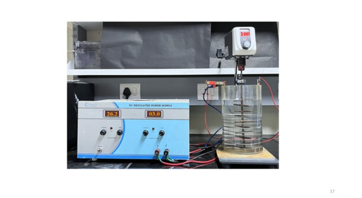
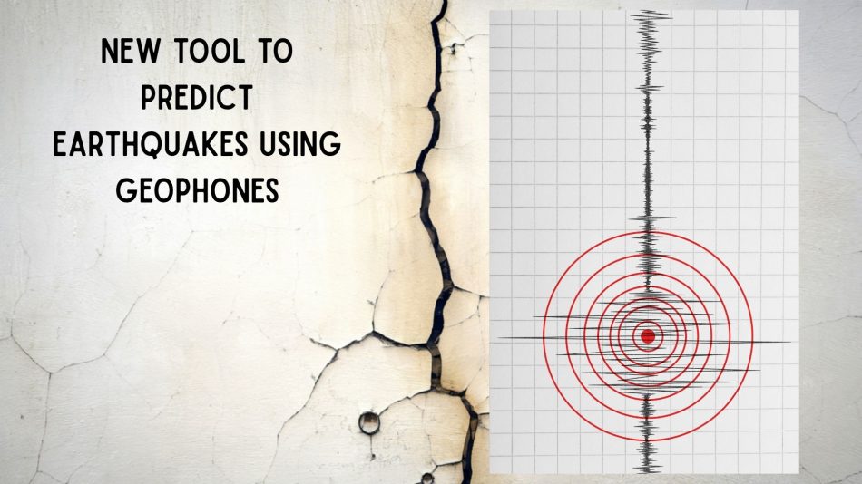
- Multichannel Analysis of Surface Waves (MASW): This non-invasive geophysical method involved generating seismic waves by striking the ground with a heavy sledgehammer. Sensitive detectors, known as geophones, were then used to measure the speed of these seismic waves as they traveled through various soil layers.
Seismic Wave Analysis
Seismic waves travel at different speeds depending on the soil’s density and composition. They move much faster through dense and stiff soils, while their speed significantly decreases when passing through soft, loose, and waterlogged ground. By analyzing these wave speeds down to a depth of thirty meters, the research team was able to identify specific areas with dangerously soft soil that are most susceptible to liquefaction during an earthquake.
Challenges with Traditional Geological Mapping
Traditionally, geological maps have relied on global classification systems that were primarily developed for North American soils. However, these older models often produced inaccurate hazard classifications for Indian geological settings due to differing weathering histories and soil compositions. Additionally, previous local studies suffered from a lack of comprehensive data, often relying on a limited number of test sites located in close proximity to each other.
Innovative Spatial Mapping Techniques
To address these challenges, the IIT Guwahati team utilized advanced spatial mapping techniques to extend their data across a vast grid. This approach enabled them to mathematically generate thousands of data points, resulting in a highly robust and region-specific mathematical formula that correlates physical soil strength with seismic wave speed.
Implications for Urban Planning and Construction
The comprehensive underground map produced by the researchers serves as a critical resource for urban planners and engineers. It allows for the precise identification of weak soil locations, enabling proactive measures to strengthen the ground before new construction projects commence. Furthermore, the data can guide the design of specialized deep foundations that are less likely to fail during seismic events.
Conclusion
The work conducted by IIT Guwahati researchers represents a significant leap forward in understanding and mitigating earthquake risks in northern Bihar. By combining traditional methods with innovative seismic wave analysis, they have created a valuable tool that can help protect communities from the devastating effects of future earthquakes.
Note: This research highlights the importance of adapting geological studies to local conditions and the potential of modern technology in enhancing disaster preparedness.