IIT Bhubaneswar and Survey of India Join Hands to Advance Geospatial Research and Innovation
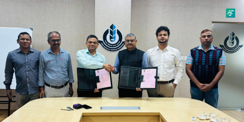
On November 25, 2025, the Indian Institute of Technology (IIT) Bhubaneswar and the Odisha & Chhattisgarh Geo-Spatial Directorate of the Survey of India (SoI) signed a significant Memorandum of Understanding (MoU) aimed at enhancing collaboration in geospatial research and innovation. This partnership is set to leverage the strengths of both institutions in the fields of geodesy, geo-informatics, and mapping technologies.
Details of the MoU Signing
The MoU was signed by:
- Prof. Dinakar Pasla, Dean (Sponsored Research & Industrial Consultancy) of IIT Bhubaneswar
- Shri Asish Kausal, IES, Director of Odisha and Chhattisgarh Geo-Spatial Directorate, Survey of India
The signing ceremony was attended by notable figures including:
- Dr. Raj K. Singh, Head, School of Earth, Ocean & Climate Sciences (SEOCS), IIT Bhubaneswar
- Dr. Ashim Sattar, Assistant Professor, SEOCS, IIT Bhubaneswar
- Shri Bharat Kumbhar, Superintending Surveyor, SoI
- Shri Shakil Alam, Officer Surveyor, SoI
Objectives of the Collaboration
The primary objective of this partnership is to combine the technical expertise of the Survey of India in geospatial science with the research capabilities of IIT Bhubaneswar in various domains such as:
- Remote sensing applications
- Geo-dynamical studies
- Climate science
- Earth sciences
Through this collaboration, both institutions aim to:
- Facilitate the exchange of scientific and technical information
- Enhance research capabilities
- Drive innovation in emerging geospatial technologies
Joint Research Projects and Knowledge Sharing
As part of the MoU, IIT Bhubaneswar and the Survey of India will engage in various collaborative efforts, including:
- Joint research projects that address critical issues in geospatial technologies
- Promotion of knowledge sharing through workshops and lectures
- Hosting conferences aimed at advancing capacity-building in the field
This initiative is expected to foster a deeper scientific understanding of geospatial technologies and their applications in various sectors, including urban planning, disaster management, and environmental monitoring.
Significance of Geospatial Research
Geospatial research is crucial in today’s data-driven world. It encompasses a wide range of applications that can significantly impact society, such as:
- Urban Planning: Utilizing geospatial data to design and manage urban spaces effectively.
- Disaster Management: Enhancing preparedness and response strategies through accurate mapping and analysis.
- Environmental Monitoring: Tracking changes in ecosystems and natural resources to promote sustainability.
The collaboration between IIT Bhubaneswar and the Survey of India is poised to make substantial contributions to these areas, ultimately benefiting communities and stakeholders across India.
Future Prospects
Looking ahead, the MoU signifies a commitment to advancing geospatial research and innovation in India. Both institutions are optimistic about the potential outcomes of their collaboration, which may include:
- Development of new geospatial technologies and methodologies
- Increased training opportunities for students and professionals in the field
- Strengthened ties between academia and government agencies
This partnership is expected to create a robust framework for future collaborations, paving the way for innovative solutions to complex geospatial challenges.
Conclusion
The collaboration between IIT Bhubaneswar and the Survey of India marks a significant step towards enhancing geospatial research and innovation in India. By combining their strengths, both institutions aim to advance scientific understanding and technological applications in this vital field. The MoU lays the groundwork for future initiatives that will benefit not only the academic community but also society at large.
Note: This article is based on information available as of November 2025 and aims to provide an overview of the collaboration between IIT Bhubaneswar and the Survey of India.